(15 ഉപയോക്താക്കൾ ചെയ്ത ഇടയ്ക്കുള്ള 35 നാൾപ്പതിപ്പുകൾ പ്രദർശിപ്പിക്കുന്നില്ല)
വരി 1:
വരി 1:
== PARAVUR THE LAND OF CULTURAL DIVERSITY പറവൂർ: സാംസ്കാരിക വൈവിധ്യങ്ങളുടെ നാട് ==
== PARAVUR THE LAND OF CULTURAL DIVERSITY പറവൂർ: സാംസ്കാരിക വൈവിധ്യങ്ങളുടെ നാട് ==
=== <u><big>North Paravoor</big></u> ===[[പ്രമാണം:25068 I T LAB.jpeg[THUMB}SCHOOL]
=== <u><big>North Paravoor</big></u> ===
North Paravur formerly known as Paravur or Paravoor or Parur, is a municipality and suburb in Ernakulam district in the Indian state of Kerala.Paravur derived its name from ancient name Parayur, which literally means the place of Paravar, an ancient tribe.It is a northern suburb of the city of Kochi and is situated around 20 km from the city centre. It is also the first place in India to use electronic voting machine during the by-elections in 1982.The '''Chendamangalam Synagogue''' is one of the oldest known synagogues built by the Malabar Jews, in Chendamangalam, a village in the Ernakulam district of the coastal state of Kerala.Now it is known for Muziris.
[[25068 Jewish synagogue.jpg|thumb|Synagogue]]
North Paravur formerly known as Paravur or Paravoor or Parur, is a municipality and suburb in Ernakulam district in the Indian state of Kerala.It is a northern suburb of the city of Kochi and is situated around 20 km from the city centre. It is also the first place in India to use electronic voting machine during the by-elections in 1982.The '''Chendamangalam Synagogue''' is one of the oldest known synagogues built by the Malabar Jews, in Chendamangalam, a village in the Ernakulam district of the coastal state of Kerala.
മുമ്പ് പറവൂർ അല്ലെങ്കിൽ പരൂർ എന്നറിയപ്പെട്ടിരുന്ന വടക്കൻ പറവൂർ, ഇന്ത്യൻ സംസ്ഥാനമായ കേരളത്തിലെ എറണാകുളം ജില്ലയിലെ ഒരു മുനിസിപ്പാലിറ്റിയും പ്രാന്തപ്രദേശവുമാണ്. കൊച്ചി നഗരത്തിൻ്റെ വടക്കൻ പ്രാന്തപ്രദേശമായ ഇത് നഗരമധ്യത്തിൽ നിന്ന് 20 കിലോമീറ്റർ അകലെയാണ് സ്ഥിതി ചെയ്യുന്നത്. പറവൂർ താലൂക്ക് എറണാകുളം ജില്ലയുടെ വടക്ക് പടിഞ്ഞാറ് ഭാഗത്ത് തൃശൂർ ജില്ലയുമായി അതിർത്തി പങ്കിടുന്നു. വൈപ്പിൻ ദ്വീപ് ഉൾപ്പെടുന്ന പടിഞ്ഞാറ് കൊച്ചി, വടക്ക് കൊടുങ്ങല്ലൂർ, വടക്ക് മാള അടങ്ങുന്ന ചാലക്കുടി, കിഴക്ക് അങ്കമാലി, നെടുമ്പാശ്ശേരി, ആലുവ എന്നിവ ഉൾപ്പെടുന്ന ആലുവ, തെക്ക് കൊച്ചി നഗരം അടങ്ങുന്ന കണയന്നൂർ എന്നിവയാണ് ചുറ്റുമുള്ള താലൂക്കുകൾ. 1982ലെ ഉപതിരഞ്ഞെടുപ്പിൽ ഇന്ത്യയിൽ ആദ്യമായി ഇലക്ട്രോണിക് വോട്ടിംഗ് യന്ത്രം ഉപയോഗിച്ചതും ഇവിടെയാണ്. ചേന്ദമംഗലത്തുള്ള ജൂത ദേവാലയമാണ് '''ചേന്ദമംഗലം ജൂതപ്പള്ളി'''. ഏകദേശം പതിനേഴാം നൂറ്റാണ്ടിലാണ് ഇത് നിർമ്മിക്കപ്പെട്ടത്.കൈത്തെറി വസ്ത്രങ്ങൾക്ക് പേരുകേട്ട ചേന്ദമംഗലം കൈത്തറിയും ഒക്കെ ഇവിടെയാണ് സ്ഥിതി ചെയ്യുന്നത്.[[പ്രമാണം:25068 classroom.jpg{thumb}]
മുമ്പ് പറവൂർ അല്ലെങ്കിൽ പരൂർ എന്നറിയപ്പെട്ടിരുന്ന വടക്കൻ പറവൂർ, ഇന്ത്യൻ സംസ്ഥാനമായ കേരളത്തിലെ എറണാകുളം ജില്ലയിലെ ഒരു മുനിസിപ്പാലിറ്റിയും പ്രാന്തപ്രദേശവുമാണ്. കൊച്ചി നഗരത്തിൻ്റെ വടക്കൻ പ്രാന്തപ്രദേശമായ ഇത് നഗരമധ്യത്തിൽ നിന്ന് 20 കിലോമീറ്റർ അകലെയാണ് സ്ഥിതി ചെയ്യുന്നത്. പറവൂർ താലൂക്ക് എറണാകുളം ജില്ലയുടെ വടക്ക് പടിഞ്ഞാറ് ഭാഗത്ത് തൃശൂർ ജില്ലയുമായി അതിർത്തി പങ്കിടുന്നു. വൈപ്പിൻ ദ്വീപ് ഉൾപ്പെടുന്ന പടിഞ്ഞാറ് കൊച്ചി, വടക്ക് കൊടുങ്ങല്ലൂർ, വടക്ക് മാള അടങ്ങുന്ന ചാലക്കുടി, കിഴക്ക് അങ്കമാലി, നെടുമ്പാശ്ശേരി, ആലുവ എന്നിവ ഉൾപ്പെടുന്ന ആലുവ, തെക്ക് കൊച്ചി നഗരം അടങ്ങുന്ന കണയന്നൂർ എന്നിവയാണ് ചുറ്റുമുള്ള താലൂക്കുകൾ. 1982ലെ ഉപതിരഞ്ഞെടുപ്പിൽ ഇന്ത്യയിൽ ആദ്യമായി ഇലക്ട്രോണിക് വോട്ടിംഗ് യന്ത്രം ഉപയോഗിച്ചതും ഇവിടെയാണ്. ചേന്ദമംഗലത്തുള്ള ജൂത ദേവാലയമാണ് '''ചേന്ദമംഗലം ജൂതപ്പള്ളി'''. ഏകദേശം പതിനേഴാം നൂറ്റാണ്ടിലാണ് ഇത് നിർമ്മിക്കപ്പെട്ടത്.കൈത്തെറി വസ്ത്രങ്ങൾക്ക് പേരുകേട്ട ചേന്ദമംഗലം കൈത്തറിയും ഒക്കെ ഇവിടെയാണ് സ്ഥിതി ചെയ്യുന്നത്.
==ചിത്രശാല==
==ചിത്രശാല==
വരി 13:
വരി 12:
=== <u>Etymology</u> ===
=== <u>Etymology</u> ===
Paravur derived its name from ancient name Parayur, which literally means the place of Paravar, an ancient tribe. Paravar were the major inhabitants of the coastal areas of Kerala especially near the ancient capital Mohodayapuram of the Chera dynasty. Descriptions about Paravar can be found in Sangha literature.
Paravur derived its name from ancient name Parayur, which literally means the place of Paravar, an ancient tribe. Paravar were the major inhabitants of the coastal areas of Kerala especially near the ancient capital Mohodayapuram of the Chera dynasty. Descriptions about Paravar can be found in Sangha literature.[[പ്രമാണം:25068 school.jpeg{school}][[പ്രമാണം:Pooram.jpeg{vibe]
=== <u>'''Overview'''</u> ===
=== <u>Overview</u> ===
The coastal highway NH-66 Panvel-Kanyakumari passes through this historic town. The National Waterway-3 Kollam-Kottapuram passes through the west end of the taluk.
The coastal highway NH-66 Panvel-Kanyakumari passes through this historic town. The National Waterway-3 Kollam-Kottapuram passes through the west end of the taluk.
Paravur is believed to be one of the 64 villages created by Parashurama. This town had been an old trading post, with a Jewish synagogue and a thriving Jewish community, before their resettlement in Israel after its establishment in 1948.[citation needed] Cochin Jews lived in the towns of Kochi and North Paravur.
Paravur is believed to be one of the 64 villages created by Parashurama. This town had been an old trading post, with a Jewish synagogue and a thriving Jewish community, before their resettlement in Israel after its establishment in 1948.[citation needed] Cochin Jews lived in the towns of Kochi and North Paravur.
The various denominations of modern Saint Thomas Christians ascribe their unwritten tradition to the end of the 1st century and believe that Thomas landed at Maliankara village in Paravur Taluk in AD 52. In AD 52 Thomas founded the churches popularly known as Ezharappallikal (seven and half churches). Two such churches are at Paravur (Kottakkaavu) and Kodunga<u>llur.</u>
The various denominations of modern Saint Thomas Christians ascribe their unwritten tradition to the end of the 1st century and believe that Thomas landed at Maliankara village in Paravur Taluk in AD 52. In AD 52 Thomas founded the churches popularly known as Ezharappallikal (seven and half churches). Two such churches are at Paravur (Kottakkaavu) and Kodunga<u>llur.</u>
=== <u>Geography</u> ===
=== <u>'''Geography'''</u> ===
[[പ്രമാണം:25068 museum.jpg|thumb|Geography]]
[[പ്രമാണം:25068 riverside.jpg|thumb|Geography]]
[[പ്രമാണം:25068 garden.jpg|thumb|Geography]]
Paravur is located at 10.14° N 76.7° E[1]. It has an average elevation of 10 metres (32 feet). The town is situated at north end of Ernakulam district and bordering with Thrissur district. The towns in Thrissur district like Kodungallore, Mala, Chalakudy and the towns Kalamassery, Aluva, Angamaly, Vypin island are located near to this town. The Paravur Taluk lies in the flat delta region of the Periyar river and cut by several canals, which have resulted in the formation of many islands. The Kodungalloor Kayal (backwaters) and Varappuzha Kayal (backwaters) are in this taluk. The town and neighboring areas were deeply affected by floods in 2018 due to heavy rain.
== '''ഭൂമിശാസ്ത്രം''' ==
10.14° N 76.7° E[1] ആണ് പറവൂർ സ്ഥിതി ചെയ്യുന്നത്. ഇതിന് ശരാശരി 10 മീറ്റർ (32 അടി) ഉയരമുണ്ട്. എറണാകുളം ജില്ലയുടെ വടക്കേ അറ്റത്തും തൃശൂർ ജില്ലയുടെ അതിർത്തിയുമായാണ് ഈ പട്ടണം സ്ഥിതി ചെയ്യുന്നത്. തൃശൂർ ജില്ലയിലെ കൊടുങ്ങല്ലൂർ, മാള, ചാലക്കുടി തുടങ്ങിയ പട്ടണങ്ങളും കളമശ്ശേരി, ആലുവ, അങ്കമാലി, വൈപ്പിൻ ദ്വീപ് തുടങ്ങിയ പട്ടണങ്ങളും ഈ പട്ടണത്തിനടുത്താണ്. പരവൂർ താലൂക്ക് പെരിയാർ നദിയുടെ പരന്ന ഡെൽറ്റ പ്രദേശത്താണ് സ്ഥിതിചെയ്യുന്നത്, നിരവധി കനാലുകളാൽ വെട്ടിമുറിച്ചു, ഇത് നിരവധി ദ്വീപുകളുടെ രൂപീകരണത്തിന് കാരണമായി. കൊടുങ്ങല്ലൂർ കായലും (കായൽ) വരാപ്പുഴ കായലും (കായൽ) ഈ താലൂക്കിലാണ്. കനത്ത മഴയെത്തുടർന്ന് 2018 ലെ വെള്ളപ്പൊക്കത്തിൽ നഗരവും സമീപ പ്രദേശങ്ങളും ആഴത്തിൽ ബാധിച്ചു.
Paliath Achan is a historical figure appearing now and then in the annals of Kerala from the 16th to the 19th centuries. It is certain that Paliam family is linked with Cochin Royal Family or ''Perumpadappu Swarupam''. Records show that with the arrival of Portughese in Kerala, Kochi Raja and Paliath Achan became important historical figures. During this time, Portughese indulged in interfering with the affairs of the Royal family with regards to adoption. This was in total conflict with the ideas of Paliath Achan and Raja of Kochi. Paliath Achan personally went to Ceylon seeking help from the Governor of Dutch and invited them to Kerala. Thus the Dutch came to power in Kerala by defeating the Portughese and there emerged a close friendship between the Dutch and Paliath Achan. In recognition of the friendship with Achan, the Dutch built a palace for Paliath Achan in Chendamangalam (shown below on the left). The Raja of Kochi was pleased with Achan and installed '''Komi Achan I''' as the Prime Minister of Kochi and proclaimed this right to pass on to Achan's descendants.
Paravur is located at 10.14° N 76.7° E[1]. It has an average elevation of 10 metres (32 feet). The town is situated at north end of Ernakulam district and bordering with Thrissur district. The towns in Thrissur district like Kodungallore, Mala, Chalakudy and the towns Kalamassery, Aluva, Angamaly, Vypin island are located near to this town. The Paravur Taluk lies in the flat delta region of the Periyar river and cut by several canals, which have resulted in the formation of many islands. The Kodungalloor Kayal (backwaters) and Varappuzha Kayal (backwaters) are in this taluk. The town and neighboring areas were deeply affected by floods in 2018 due to heavy rain.
=== <u>Notable persons</u> ===
=== Paravoor T K Narayana Pillai( 25 March 1890- 23 June 1971) ===
Paliath Achan is a historical figure appearing now and then in the annals of Kerala from the 16th to the 19th centuries. It is certain that Paliam family is linked with Cochin Royal Family or ''Perumpadappu Swarupam''. Records show that with the arrival of Portughese in Kerala, Kochi Raja and Paliath Achan became important historical figures. During this time, Portughese indulged in interfering with the affairs of the Royal family with regards to adoption. This was in total conflict with the ideas of Paliath Achan and Raja of Kochi. Paliath Achan personally went to Ceylon seeking help from the Governor of Dutch and invited them to Kerala. Thus the Dutch came to power in Kerala by defeating the Portughese and there emerged a close friendship between the Dutch and Paliath Achan. In recognition of the friendship with Achan, the Dutch built a palace for Paliath Achan in Chendamangalam (shown below on the left). The Raja of Kochi was pleased with Achan and installed '''Komi Achan I''' as the Prime Minister of Kochi and proclaimed this right to pass on to Achan's descendants.
[[പ്രമാണം:Paravoor tk.jpg|ലഘുചിത്രം|Paravoor T K Narayana Pillai]]
He was an indian freedom fighter during the british raj in india and was a member of the indian nation congress which fought against the british rule in india.He was the last prime minister of Travencore and the first chief minister of travencore-cochin at the time of its formation in 1949.He was commonly known as Parur T K.
=== <u>Educational institutions</u> ===
=== <u>Educational institutions</u> ===
വരി 40:
വരി 54:
* SNMIMT Engineering college,Maliankara
* SNMIMT Engineering college,Maliankara
* SNM Training college , moothakunnam
* SNM Training college , moothakunnam
* SNM ITC Moothakunnam
* SNM TTI, Moothakunnam
* Donbosco, Fort road
* Little Hearts, Kizhkepram, Paravur
* Mar Gregorious School, Paravur
* Maria Teresa Scrilli public school, court road North paravur
* Tiny Tots Pre- Primary Smart School Valluvally N. Paravur
* Chris Chappel college North Paravur
* Tiny Tots Day Care, Play School & Pre School (N. Parvoor)
* Tiny Tots Pre-Primary Smart School/Day Care/Play School Vazhikulangara North Paravur
Paravur was under the administration of the Paravur king. Vypin was also in Parur. The Paravur king joined with Kochi country, but later Parur transferred to the Travancore area (1864) as part of an agreement. The taluk was divided into Paravur and Alangad. Alangad comprised most parts of present-day Aluva taluk. At that period Paravur area included Puthenchira, Mala area of Chalakudy taluk. Muziris was the centre of Indian spice trade for many centuries, and was known to the Yavanas (Greeks) as well as Romans, Jews, Arabs, and Chinese since ancient times. Kochi rose to significance as a trading centre after the port at Muziris was destroyed by massive flooding of the river Periyar in 1341. It was told till that time the Periyar River had a width of Cherai to Munambam. The mud and sand destroyed this natural port and the whole City along with its wealth went below the mud and sand.
Paravur was under the administration of the Paravur king. Vypin was also in Parur. The Paravur king joined with Kochi country, but later Parur transferred to the Travancore area (1864) as part of an agreement. The taluk was divided into Paravur and Alangad. Alangad comprised most parts of present-day Aluva taluk. At that period Paravur area included Puthenchira, Mala area of Chalakudy taluk. Muziris was the centre of Indian spice trade for many centuries, and was known to the Yavanas (Greeks) as well as Romans, Jews, Arabs, and Chinese since ancient times. Kochi rose to significance as a trading centre after the port at Muziris was destroyed by massive flooding of the river Periyar in 1341. It was told till that time the Periyar River had a width of Cherai to Munambam. The mud and sand destroyed this natural port and the whole City along with its wealth went below the mud and sand.
== '''ചരിത്രം''' ==
പറവൂർ രാജാവിൻ്റെ ഭരണത്തിൻ കീഴിലായിരുന്നു പറവൂർ. വൈപ്പിൻ പരൂരിലും ഉണ്ടായിരുന്നു. പറവൂർ രാജാവ് കൊച്ചി രാജ്യവുമായി ചേർന്നെങ്കിലും പിന്നീട് ഒരു കരാറിൻ്റെ ഭാഗമായി പരൂർ തിരുവിതാംകൂർ പ്രദേശത്തേക്ക് മാറ്റപ്പെട്ടു (1864). താലൂക്കിനെ പറവൂർ, ആലങ്ങാട് എന്നിങ്ങനെ വിഭജിച്ചു. ഇന്നത്തെ ആലുവ താലൂക്കിൻ്റെ ഭൂരിഭാഗം ഭാഗങ്ങളും ഉൾപ്പെട്ടതായിരുന്നു ആലങ്ങാട്. അക്കാലത്ത് പറവൂർ പ്രദേശം ചാലക്കുടി താലൂക്കിലെ പുത്തൻചിറയും മാളയും ഉൾപ്പെട്ടിരുന്നു. നിരവധി നൂറ്റാണ്ടുകളായി ഇന്ത്യൻ സുഗന്ധവ്യഞ്ജന വ്യാപാരത്തിൻ്റെ കേന്ദ്രമായിരുന്നു മുസിരിസ്, പുരാതന കാലം മുതൽ യവനന്മാർക്കും (ഗ്രീക്കുകാർ) റോമാക്കാർക്കും ജൂതന്മാർക്കും അറബികൾക്കും ചൈനക്കാർക്കും അറിയാമായിരുന്നു. 1341-ൽ പെരിയാർ നദി കരകവിഞ്ഞൊഴുകി മുസിരിസ് തുറമുഖം തകർന്നതിനെ തുടർന്നാണ് കൊച്ചി ഒരു വ്യാപാര കേന്ദ്രമെന്ന നിലയിൽ പ്രാധാന്യമർഹിക്കുന്നത്. പെരിയാർ നദിക്ക് ചെറായി മുതൽ മുനമ്പം വരെ വീതിയുണ്ടായിരുന്നുവെന്ന് അന്നുവരെ പറയപ്പെട്ടിരുന്നു. ചെളിയും മണലും ഈ പ്രകൃതിദത്ത തുറമുഖത്തെ നശിപ്പിച്ചു, നഗരം മുഴുവൻ അതിൻ്റെ സമ്പത്തും ചെളിക്കും മണലിനും താഴെയായി.
=== '''<u>Demographics</u>''' ===
=== '''<u>Demographics</u>''' ===
വരി 60:
വരി 89:
=== '''<u>Economy</u>''' ===
=== '''<u>Economy</u>''' ===
Paravur was once famous in the district for its traditional industries like coir, handlooms and agriculture. Now it is changing to a major residential suburb of Cochin where people looking jobs in city. The Eloor-Edayar industrial belt is in Paravur Taluk.
Paravur was once famous in the district for its traditional industries like coir, handlooms and agriculture. Now it is changing to a major residential suburb of Cochin where people looking jobs in city. The Eloor-Edayar industrial belt is in Paravur Taluk.[[പ്രമാണം:Palium palace 25068.resized.JPG|thumb|പാലിയം കൊട്ടാരം]]
Chendamangalam a historical place is also in Paravur. Chendamangalam was the place of Paliath Achans who were the prime ministers and Raja under the Kochi Maharaja. In Chendamangalam, exists the famous Dutch-Kerala style constructed Palace and Nalukettu of the Paliam Royal Family(Paliath Achan).Chavara monastery is in Koonammavu. North Paravur municipality is one among the former municipalities in Ernakulam District. Today it is a populated residential town in the Ernakulam district due to its historical importance. Gothuruth, an island in Parur, is the birthplace of the traditional Kerala art form of Chavittunatakam.
Chendamangalam a historical place is also in Paravur. Chendamangalam was the place of Paliath Achans who were the prime ministers and Raja under the Kochi Maharaja. In Chendamangalam, exists the famous Dutch-Kerala style constructed Palace and Nalukettu of the Paliam Royal Family(Paliath Achan).Chavara monastery is in Koonammavu. North Paravur municipality is one among the former municipalities in Ernakulam District. Today it is a populated residential town in the Ernakulam district due to its historical importance. Gothuruth, an island in Parur, is the birthplace of the traditional Kerala art form of Chavittunatakam.
=== <u>worship places</u> ===
* [[പ്രമാണം:St thomas2.jpg|ലഘുചിത്രം]]ST Thomas Kottakkavu Ferona church N.Paravoor
* Paravoor Juma masjid
* Paravoor synagogue
* Peruvaram mahadeva temple N.Paravoor
* Kannamkulangara sree krishna temple N.Paravoor
*
=== <u>സസ്യ ജീവ ജാലങ്ങൾ</u> ===
=== <u>സസ്യ ജീവ ജാലങ്ങൾ</u> ===
വരി 68:
വരി 106:
=== <u>Localities in Paravur</u> ===
=== <u>Localities in Paravur</u> ===
These are the localities or wards in Paravur Municipality. Perumpadanna, Kedamangalam, Nanthiattukunnam, Peruvaram, Vazhikulangara, Kizhakkepram, Vedimara, Pullamkulam, Vaniyakkad, Nandikulangara, Paravoothara, Pallamthuruth, Mattumal, Kurunthotiparamb, Poosaripady, Thoniyakav, Potten street, Mookambi, Municipal, Kacheripady|Court, Chendamangalam Jn, Thekkenaluvazhi, Market, Kannankulangara, Pvt. Busstand
These are the localities or wards in Paravur Municipality. Perumpadanna, Kedamangalam, Nanthiattukunnam, Peruvaram, Vazhikulangara, Kizhakkepram, Vedimara, Pullamkulam, Vaniyakkad, Nandikulangara, Paravoothara, Pallamthuruth, Mattumal, Kurunthotiparamb, Poosaripady, Thoniyakav, Potten street, Mookambi, Municipal, Kacheripady|Court, Chendamangalam Jn, Thekkenaluvazhi, Market, Kannankulangara, Pvt. Busstand
=== <u>ചിത്രശാല</u> ===
=== <u>ചിത്രശാല</u> ===
വരി 138:
വരി 177:
* SNM IMT
* SNM IMT
* Canara Bank
* Canara Bank
* FEDERAL BANK
=== <u>Educational organizations in North Paravur</u> ===
=== <u>Educational organizations in North Paravur</u> ===
Sree Narayana Medical College, Chalaka
Sree Narayana Medical College, Chalaka
വരി 186:
വരി 226:
* Mannam Thaypooyam Festival
* Mannam Thaypooyam Festival
* Peruvaram Temple Festival
* Peruvaram Temple Festival
* Cherai pooram
== പ്രധാന വ്യവസായങ്ങൾ ==
== പ്രധാന വ്യവസായങ്ങൾ ==
വരി 192:
വരി 233:
== വിനോദസഞ്ചാരം ==
== വിനോദസഞ്ചാരം ==
മനോഹരമായ ചെറായി ബീച്ച് ഇവിടെനിന്നും 6 കിലോമീറ്റർ അകലെയാണ്. പറവൂർ പഴയ ഒരു വാണിജ്യ കേന്ദ്രവും ജൂത കുടിയേറ്റ മേഖലയുമായിരുന്നു . ഒരു ജൂത സിനഗോഗും ഇവിടെ ഉണ്ട്. ജൂതതെരുവ് എന്ന ഒരു പ്രദേശവും ഇവിടെ ഉണ്ട്. ഒരുപാട് ജൂതന്മാർ ഇവിടെനിന്നും ഇസ്രായേൽ രൂപവത്കരിച്ചപ്പോൾ ഇസ്രായേലിലേക്ക് കുടിയേറിപ്പാർത്തു. എറണാകുളം ജില്ലയുടെ വടക്കു ഭാഗത്തായി എറണാകുളം-തൃശ്ശൂർ അതിർത്തിയിലാണ് പറവൂർ സ്ഥിതി ചെയ്യുന്നത്. പറവൂരിന്റെ ഒരതിര് വൈപ്പിൻ ദ്വീപ് ആണ് , മറ്റൊരതിര് തൃശ്ശൂർ ജില്ല ആണ്. പുതിയ വിനോദസഞ്ചാര കേന്ദ്രമായി വികസിക്കപ്പെടുന്ന കോട്ടയിൽകോവിലകം പറവൂരിലാണ്. മുസിരിസ് വികസന പദ്ധതിയുടെ ഭാഗമായി പറവൂരിൽ നിരവധി വിനോദ സഞ്ചാര പദ്ധതികൾ പുരോഗമിക്കുന്നു. എ.ഡി. 52 ൽ സെന്റ് തോമസിനാൽ സ്ഥാപിതമായ കോട്ടക്കാവ് പള്ളി പ്രസിദ്ധമായ തീർത്ഥാടനകേന്ദ്രമാണ്. വിശുദ്ധ തോമാസ് സ്ഥാപിച്ച ഏഴരപള്ളികളിൽ ഒന്നാണ് കോട്ടക്കാവ് പള്ളി. ഇന്ത്യയിലെ ആദ്യ ക്രൈസ്തവദേവാലയമാണിതെന്ന് കരുതപ്പെടുന്നുണ്ട്.
മനോഹരമായ ചെറായി ബീച്ച് ഇവിടെനിന്നും 6 കിലോമീറ്റർ അകലെയാണ്. പറവൂർ പഴയ ഒരു വാണിജ്യ കേന്ദ്രവും ജൂത കുടിയേറ്റ മേഖലയുമായിരുന്നു . ഒരു ജൂത സിനഗോഗും ഇവിടെ ഉണ്ട്.
ജൂതതെരുവ് എന്ന ഒരു പ്രദേശവും ഇവിടെ ഉണ്ട്. ഒരുപാട് ജൂതന്മാർ ഇവിടെനിന്നും ഇസ്രായേൽ രൂപവത്കരിച്ചപ്പോൾ ഇസ്രായേലിലേക്ക് കുടിയേറിപ്പാർത്തു. എറണാകുളം ജില്ലയുടെ വടക്കു ഭാഗത്തായി എറണാകുളം-തൃശ്ശൂർ അതിർത്തിയിലാണ് പറവൂർ സ്ഥിതി ചെയ്യുന്നത്. പറവൂരിന്റെ ഒരതിര് വൈപ്പിൻ ദ്വീപ് ആണ് , മറ്റൊരതിര് തൃശ്ശൂർ ജില്ല ആണ്. പുതിയ വിനോദസഞ്ചാര കേന്ദ്രമായി വികസിക്കപ്പെടുന്ന കോട്ടയിൽകോവിലകം പറവൂരിലാണ്. മുസിരിസ് വികസന പദ്ധതിയുടെ ഭാഗമായി പറവൂരിൽ നിരവധി വിനോദ സഞ്ചാര പദ്ധതികൾ പുരോഗമിക്കുന്നു. എ.ഡി. 52 ൽ സെന്റ് തോമസിനാൽ സ്ഥാപിതമായ കോട്ടക്കാവ് പള്ളി പ്രസിദ്ധമായ തീർത്ഥാടനകേന്ദ്രമാണ്. വിശുദ്ധ തോമാസ് സ്ഥാപിച്ച ഏഴരപള്ളികളിൽ ഒന്നാണ് കോട്ടക്കാവ് പള്ളി. ഇന്ത്യയിലെ ആദ്യ ക്രൈസ്തവദേവാലയമാണിതെന്ന് കരുതപ്പെടുന്നുണ്ട്.
== HOSPITALS ==
* DON BOSCO HOSPITAL
* KMK HOSPITAL
* TALUK HEADQUARTERS HOSPITAL
* SHAJY HOSPITAL
* SHANTHI HOSPITAL
* CHAITHANYA HOSPITAL
* BHARATH RURAL HOSPITAL
= TEMPLES =
.DAKSHINA MOOKAMBIKA TEMPLE
PERUVARAM MAHADEVA TEMPLE
CHILLIKOODAM TEMPLE
PANIKARACHAN TEMPLE
KALIKULANGARA TEMPLE
SREE KUMARAMANGALAM SUBRAMANYASWAMY TEMPLE
==References==
==References==
12:19, 26 ജനുവരി 2025-നു നിലവിലുള്ള രൂപം
PARAVUR THE LAND OF CULTURAL DIVERSITY പറവൂർ: സാംസ്കാരിക വൈവിധ്യങ്ങളുടെ നാട്
=== North Paravoor ===[[പ്രമാണം:25068 I T LAB.jpeg[THUMB}SCHOOL]
North Paravur formerly known as Paravur or Paravoor or Parur, is a municipality and suburb in Ernakulam district in the Indian state of Kerala.Paravur derived its name from ancient name Parayur, which literally means the place of Paravar, an ancient tribe.It is a northern suburb of the city of Kochi and is situated around 20 km from the city centre. It is also the first place in India to use electronic voting machine during the by-elections in 1982.The Chendamangalam Synagogue is one of the oldest known synagogues built by the Malabar Jews, in Chendamangalam, a village in the Ernakulam district of the coastal state of Kerala.Now it is known for Muziris.
thumb|Synagogue
മുമ്പ് പറവൂർ അല്ലെങ്കിൽ പരൂർ എന്നറിയപ്പെട്ടിരുന്ന വടക്കൻ പറവൂർ, ഇന്ത്യൻ സംസ്ഥാനമായ കേരളത്തിലെ എറണാകുളം ജില്ലയിലെ ഒരു മുനിസിപ്പാലിറ്റിയും പ്രാന്തപ്രദേശവുമാണ്. കൊച്ചി നഗരത്തിൻ്റെ വടക്കൻ പ്രാന്തപ്രദേശമായ ഇത് നഗരമധ്യത്തിൽ നിന്ന് 20 കിലോമീറ്റർ അകലെയാണ് സ്ഥിതി ചെയ്യുന്നത്. പറവൂർ താലൂക്ക് എറണാകുളം ജില്ലയുടെ വടക്ക് പടിഞ്ഞാറ് ഭാഗത്ത് തൃശൂർ ജില്ലയുമായി അതിർത്തി പങ്കിടുന്നു. വൈപ്പിൻ ദ്വീപ് ഉൾപ്പെടുന്ന പടിഞ്ഞാറ് കൊച്ചി, വടക്ക് കൊടുങ്ങല്ലൂർ, വടക്ക് മാള അടങ്ങുന്ന ചാലക്കുടി, കിഴക്ക് അങ്കമാലി, നെടുമ്പാശ്ശേരി, ആലുവ എന്നിവ ഉൾപ്പെടുന്ന ആലുവ, തെക്ക് കൊച്ചി നഗരം അടങ്ങുന്ന കണയന്നൂർ എന്നിവയാണ് ചുറ്റുമുള്ള താലൂക്കുകൾ. 1982ലെ ഉപതിരഞ്ഞെടുപ്പിൽ ഇന്ത്യയിൽ ആദ്യമായി ഇലക്ട്രോണിക് വോട്ടിംഗ് യന്ത്രം ഉപയോഗിച്ചതും ഇവിടെയാണ്. ചേന്ദമംഗലത്തുള്ള ജൂത ദേവാലയമാണ് ചേന്ദമംഗലം ജൂതപ്പള്ളി. ഏകദേശം പതിനേഴാം നൂറ്റാണ്ടിലാണ് ഇത് നിർമ്മിക്കപ്പെട്ടത്.കൈത്തെറി വസ്ത്രങ്ങൾക്ക് പേരുകേട്ട ചേന്ദമംഗലം കൈത്തറിയും ഒക്കെ ഇവിടെയാണ് സ്ഥിതി ചെയ്യുന്നത്.[[പ്രമാണം:25068 classroom.jpg{thumb}]
ചിത്രശാല
നോർത്ത് പറവൂർ കോടതി സമുച്ചയം
Etymology
Paravur derived its name from ancient name Parayur, which literally means the place of Paravar, an ancient tribe. Paravar were the major inhabitants of the coastal areas of Kerala especially near the ancient capital Mohodayapuram of the Chera dynasty. Descriptions about Paravar can be found in Sangha literature.[[പ്രമാണം:25068 school.jpeg{school}][[പ്രമാണം:Pooram.jpeg{vibe]
Overview
The coastal highway NH-66 Panvel-Kanyakumari passes through this historic town. The National Waterway-3 Kollam-Kottapuram passes through the west end of the taluk.
Paravur is believed to be one of the 64 villages created by Parashurama. This town had been an old trading post, with a Jewish synagogue and a thriving Jewish community, before their resettlement in Israel after its establishment in 1948.[citation needed] Cochin Jews lived in the towns of Kochi and North Paravur.
The various denominations of modern Saint Thomas Christians ascribe their unwritten tradition to the end of the 1st century and believe that Thomas landed at Maliankara village in Paravur Taluk in AD 52. In AD 52 Thomas founded the churches popularly known as Ezharappallikal (seven and half churches). Two such churches are at Paravur (Kottakkaavu) and Kodungallur.
Geography
GeographyGeographyGeography
Paravur is located at 10.14° N 76.7° E[1]. It has an average elevation of 10 metres (32 feet). The town is situated at north end of Ernakulam district and bordering with Thrissur district. The towns in Thrissur district like Kodungallore, Mala, Chalakudy and the towns Kalamassery, Aluva, Angamaly, Vypin island are located near to this town. The Paravur Taluk lies in the flat delta region of the Periyar river and cut by several canals, which have resulted in the formation of many islands. The Kodungalloor Kayal (backwaters) and Varappuzha Kayal (backwaters) are in this taluk. The town and neighboring areas were deeply affected by floods in 2018 due to heavy rain.
ഭൂമിശാസ്ത്രം
10.14° N 76.7° E[1] ആണ് പറവൂർ സ്ഥിതി ചെയ്യുന്നത്. ഇതിന് ശരാശരി 10 മീറ്റർ (32 അടി) ഉയരമുണ്ട്. എറണാകുളം ജില്ലയുടെ വടക്കേ അറ്റത്തും തൃശൂർ ജില്ലയുടെ അതിർത്തിയുമായാണ് ഈ പട്ടണം സ്ഥിതി ചെയ്യുന്നത്. തൃശൂർ ജില്ലയിലെ കൊടുങ്ങല്ലൂർ, മാള, ചാലക്കുടി തുടങ്ങിയ പട്ടണങ്ങളും കളമശ്ശേരി, ആലുവ, അങ്കമാലി, വൈപ്പിൻ ദ്വീപ് തുടങ്ങിയ പട്ടണങ്ങളും ഈ പട്ടണത്തിനടുത്താണ്. പരവൂർ താലൂക്ക് പെരിയാർ നദിയുടെ പരന്ന ഡെൽറ്റ പ്രദേശത്താണ് സ്ഥിതിചെയ്യുന്നത്, നിരവധി കനാലുകളാൽ വെട്ടിമുറിച്ചു, ഇത് നിരവധി ദ്വീപുകളുടെ രൂപീകരണത്തിന് കാരണമായി. കൊടുങ്ങല്ലൂർ കായലും (കായൽ) വരാപ്പുഴ കായലും (കായൽ) ഈ താലൂക്കിലാണ്. കനത്ത മഴയെത്തുടർന്ന് 2018 ലെ വെള്ളപ്പൊക്കത്തിൽ നഗരവും സമീപ പ്രദേശങ്ങളും ആഴത്തിൽ ബാധിച്ചു.
Notable persons
Paliyam KottaramPALIYATHACHAN
Paliath Achan is a historical figure appearing now and then in the annals of Kerala from the 16th to the 19th centuries. It is certain that Paliam family is linked with Cochin Royal Family or Perumpadappu Swarupam. Records show that with the arrival of Portughese in Kerala, Kochi Raja and Paliath Achan became important historical figures. During this time, Portughese indulged in interfering with the affairs of the Royal family with regards to adoption. This was in total conflict with the ideas of Paliath Achan and Raja of Kochi. Paliath Achan personally went to Ceylon seeking help from the Governor of Dutch and invited them to Kerala. Thus the Dutch came to power in Kerala by defeating the Portughese and there emerged a close friendship between the Dutch and Paliath Achan. In recognition of the friendship with Achan, the Dutch built a palace for Paliath Achan in Chendamangalam (shown below on the left). The Raja of Kochi was pleased with Achan and installed Komi Achan I as the Prime Minister of Kochi and proclaimed this right to pass on to Achan's descendants.
Paravoor T K Narayana Pillai( 25 March 1890- 23 June 1971)
Paravoor T K Narayana Pillai
He was an indian freedom fighter during the british raj in india and was a member of the indian nation congress which fought against the british rule in india.He was the last prime minister of Travencore and the first chief minister of travencore-cochin at the time of its formation in 1949.He was commonly known as Parur T K.
Educational institutions
Government Upper Primary School,Vadakkumpuram
Sree Narayana Higher Secondarty School, North Paravur
St. Aloysius Higher Secondary School, North Paravur
Infant Jesus Senior Secondary School, Kurumthottiparamb, 'North Paravur'
Holy India Group,(town)& Kaitharam, 'North Paravur'
Santa Cruz Lower primary School Koottukad
S N M higher secondary school moothakunnam
SNGIST Professional college,Manjaly
MES College of Engineering,kunnukara
SNM College of Arts and science,maliankara
SNMIMT Engineering college,Maliankara
SNM Training college , moothakunnam
SNM ITC Moothakunnam
SNM TTI, Moothakunnam
Donbosco, Fort road
Little Hearts, Kizhkepram, Paravur
Mar Gregorious School, Paravur
Maria Teresa Scrilli public school, court road North paravur
Tiny Tots Pre- Primary Smart School Valluvally N. Paravur
Chris Chappel college North Paravur
Tiny Tots Day Care, Play School & Pre School (N. Parvoor)
Tiny Tots Pre-Primary Smart School/Day Care/Play School Vazhikulangara North Paravur
ചിത്രശാല
ശ്രീ നാരായണ ഹയർ സെക്കന്ററി സ്കൂൾ നോർത്ത് പറവൂർ
Chitrashala(Gallery)
Jewish Synagogue
History
Paravur was under the administration of the Paravur king. Vypin was also in Parur. The Paravur king joined with Kochi country, but later Parur transferred to the Travancore area (1864) as part of an agreement. The taluk was divided into Paravur and Alangad. Alangad comprised most parts of present-day Aluva taluk. At that period Paravur area included Puthenchira, Mala area of Chalakudy taluk. Muziris was the centre of Indian spice trade for many centuries, and was known to the Yavanas (Greeks) as well as Romans, Jews, Arabs, and Chinese since ancient times. Kochi rose to significance as a trading centre after the port at Muziris was destroyed by massive flooding of the river Periyar in 1341. It was told till that time the Periyar River had a width of Cherai to Munambam. The mud and sand destroyed this natural port and the whole City along with its wealth went below the mud and sand.
ചരിത്രം
പറവൂർ രാജാവിൻ്റെ ഭരണത്തിൻ കീഴിലായിരുന്നു പറവൂർ. വൈപ്പിൻ പരൂരിലും ഉണ്ടായിരുന്നു. പറവൂർ രാജാവ് കൊച്ചി രാജ്യവുമായി ചേർന്നെങ്കിലും പിന്നീട് ഒരു കരാറിൻ്റെ ഭാഗമായി പരൂർ തിരുവിതാംകൂർ പ്രദേശത്തേക്ക് മാറ്റപ്പെട്ടു (1864). താലൂക്കിനെ പറവൂർ, ആലങ്ങാട് എന്നിങ്ങനെ വിഭജിച്ചു. ഇന്നത്തെ ആലുവ താലൂക്കിൻ്റെ ഭൂരിഭാഗം ഭാഗങ്ങളും ഉൾപ്പെട്ടതായിരുന്നു ആലങ്ങാട്. അക്കാലത്ത് പറവൂർ പ്രദേശം ചാലക്കുടി താലൂക്കിലെ പുത്തൻചിറയും മാളയും ഉൾപ്പെട്ടിരുന്നു. നിരവധി നൂറ്റാണ്ടുകളായി ഇന്ത്യൻ സുഗന്ധവ്യഞ്ജന വ്യാപാരത്തിൻ്റെ കേന്ദ്രമായിരുന്നു മുസിരിസ്, പുരാതന കാലം മുതൽ യവനന്മാർക്കും (ഗ്രീക്കുകാർ) റോമാക്കാർക്കും ജൂതന്മാർക്കും അറബികൾക്കും ചൈനക്കാർക്കും അറിയാമായിരുന്നു. 1341-ൽ പെരിയാർ നദി കരകവിഞ്ഞൊഴുകി മുസിരിസ് തുറമുഖം തകർന്നതിനെ തുടർന്നാണ് കൊച്ചി ഒരു വ്യാപാര കേന്ദ്രമെന്ന നിലയിൽ പ്രാധാന്യമർഹിക്കുന്നത്. പെരിയാർ നദിക്ക് ചെറായി മുതൽ മുനമ്പം വരെ വീതിയുണ്ടായിരുന്നുവെന്ന് അന്നുവരെ പറയപ്പെട്ടിരുന്നു. ചെളിയും മണലും ഈ പ്രകൃതിദത്ത തുറമുഖത്തെ നശിപ്പിച്ചു, നഗരം മുഴുവൻ അതിൻ്റെ സമ്പത്തും ചെളിക്കും മണലിനും താഴെയായി.
Demographics
As of 2011 Census, Paravur had a population of 31,503 with 15,060 males and 16,443 females. Paravur municipality have an area of 9.02 km2 (3.48 sq mi) with 8,095 families residing in it. 8% of the population was under 6 years of age. Paravur had an average literacy of 96.75% higher than the state average of 94%: male literacy was 97.8% and female literacy was 95.8%.
Economy
Paravur was once famous in the district for its traditional industries like coir, handlooms and agriculture. Now it is changing to a major residential suburb of Cochin where people looking jobs in city. The Eloor-Edayar industrial belt is in Paravur Taluk.
പാലിയം കൊട്ടാരം
Chendamangalam a historical place is also in Paravur. Chendamangalam was the place of Paliath Achans who were the prime ministers and Raja under the Kochi Maharaja. In Chendamangalam, exists the famous Dutch-Kerala style constructed Palace and Nalukettu of the Paliam Royal Family(Paliath Achan).Chavara monastery is in Koonammavu. North Paravur municipality is one among the former municipalities in Ernakulam District. Today it is a populated residential town in the Ernakulam district due to its historical importance. Gothuruth, an island in Parur, is the birthplace of the traditional Kerala art form of Chavittunatakam.
worship places
ST Thomas Kottakkavu Ferona church N.Paravoor
Paravoor Juma masjid
Paravoor synagogue
Peruvaram mahadeva temple N.Paravoor
Kannamkulangara sree krishna temple N.Paravoor
സസ്യ ജീവ ജാലങ്ങൾ
തെങ്ങുകളുടെ സാന്ദ്രത ഏറ്റവും കൂടിയ പ്രദേശങ്ങളിലൊന്നാണ് വടക്കൻ പറവൂർ. മറ്റ് പക്ഷികളുടേയും മൃഗങ്ങളുടേയും വിശാലമായ ശ്രേണിയും ഈ ദേശത്തിനുണ്ട്. കിംഗ്ഫിഷർ നീലപ്പൊൻമാൻ ഈ നാട്ടിലെ സാധാരണ പക്ഷിയാണ്, മറ്റുള്ളവയിൽ കറുത്ത ബുൾബുൾ (സീസൺ അനുസരിച്ച്) ബ്രൗൺ ഫാൽക്കൺ, മരപ്പട്ടി, കുരുവികൾ, കാക്കകൾ, പ്രാവുകൾ, ആഫ്രിക്കൻ മത്സ്യം കഴുകൻ, കൊക്കകൾ എന്നിവ ഉൾപ്പെടുന്നു. ശാന്തമായ ഈ താലൂക്കിൽ മത്സ്യങ്ങൾ സമൃദ്ധമാണ്.
Localities in Paravur
Locality
These are the localities or wards in Paravur Municipality. Perumpadanna, Kedamangalam, Nanthiattukunnam, Peruvaram, Vazhikulangara, Kizhakkepram, Vedimara, Pullamkulam, Vaniyakkad, Nandikulangara, Paravoothara, Pallamthuruth, Mattumal, Kurunthotiparamb, Poosaripady, Thoniyakav, Potten street, Mookambi, Municipal, Kacheripady|Court, Chendamangalam Jn, Thekkenaluvazhi, Market, Kannankulangara, Pvt. Busstand
ചിത്രശാല
കേസരി ബാലക്രിഷ്ണ പിളള സ്മാരക മ്യുസിയം
അംബേദ്കർ പാർക്ക്
മുനിസിപ്പൽ ടൗൺ ഹാൾ
കുട്ടികളുടെ പാർക്ക്
Transport
KL-42 is the RTO code for Paravur Taluk, Vypin island and North Paravur. Paravur JRTO is situated at Perumpadanna. There is a KSRTC Subdepot, Private Limited Stop bus stand and a private bus stand in the town conducting services to many places in Kerala. There is frequent bus service to Ernakulam, Malabar from here. The nearest railway station is Aluva 16 km away. The Cochin International Airport at Nedumbassery is about 20 km away from the town. There are frequent boat and ferry services on the nearby rivers and lagoons.[citation needed]
Every year boat races are organised in different parts of Paravur and major one is North Paravur water race. Paravur is famous for tug of wars. Volleyball is a popular game in Paravur. There is a municipal stadium in Paravur and FACT ground in Eloor. There are plans to build a swimming pond in the taluk. There is a municipal park in Pullamkulam, near to Peruvaram which is well maintained.
   Sree Narayana Medical College, Chalaka
   SNMIMT Engineering college, Maliankara
   SNGIST Professional College, Manjaly
   MES College of Engineering and Technology, Kunnukara
   Holymatha College of Technology, Manakkapady
   SNGIST Arts & Science College, Manakkappady
   MES Arts and Science College, Kunnukara
   Lakshmi College, Was one of the biggest parallel colleges once.
   SNM Training College, Moothakunnam (Aided)
   Sree Narayana Higher Secondary School, Pullamkulam, North Paravur
   Infant Jesus Public School,Perumbadanna, North Paravur
   Adarsha Vidya Bhavan Senior Secondary School, Nanthiyaattkunnam, North Paravur
   MES Central School, Kunnukara and Eloor
   Government Higher Secondary School (Boys), North Paravur
   Government Higher Secondary School (Girls), North Paravur
   S.N.V Sanskrit School Nanthiyattukunnam
   Hindi Prachara Sabha, Alengad
   St. Germains Zion L P School
   Sree Narayana Arts and Science coll Kedamangalamalam
   Mar gregorios Abdul jaleel Arts and science college, North paravur
Landmarks
Periyar branch: Paravur river
Chinese fishing nets in lagoons
Pattanam, archeological site & tourism circuit
Kottayil Kovilakam
Chendamangalam,
Mouth of Chalakudy River
Varappuzha lagoon and bridge
North Paravur Town
Paliyam Palace Museum
Dakshina Mookambika Temple North Paravur
Kottakkavu Mar Thoma Syro-Malabar Pilgrim Church, North Paravur, founded by St. Thomas in AD 52
St. Thomas Jacobite Syrian Church, North Paravur where the tomb of Mar Gregorios Abdul Jaleel
Paravur Synagogue is a historical Jewish place of worship
Festivals
Paravur Mookambika Navarathri festival
Kalikulangara valiyavilakku fest
Moothakunam temple fest
Dukrana of St. Thomas the Apostle.
Chakkumarassery Temple Fest
The celebration of Sacred Heart of Jesus, Don Bosco Church North Paravur.
Perumpadanna Holi fest at Perumpadanna KSMS Mahadeva temple.
Mannam Thaypooyam Festival
Peruvaram Temple Festival
Cherai pooram
പ്രധാന വ്യവസായങ്ങൾ
ചേന്ദമംഗലം കൈത്തറി
പണ്ട് കാലങ്ങളിൽ പാരമ്പര്യ വ്യവസായങ്ങളായ കയർ നിർമ്മാണം, കൈത്തറി, കൃഷി എന്നിവക്ക് പേര് കേട്ട സ്ഥലം ആയിരുന്നു പറവൂർ. ചേന്ദമംഗലം കൈത്തറി ഇന്നും പ്രസിദ്ധമാണ്. ഏലൂർ-എടയാർ വ്യവസായ മേഖല പറവൂർ താലൂക്കിൽ ആണ്.
വിനോദസഞ്ചാരം
CHERAI BEACH
മനോഹരമായ ചെറായി ബീച്ച് ഇവിടെനിന്നും 6 കിലോമീറ്റർ അകലെയാണ്. പറവൂർ പഴയ ഒരു വാണിജ്യ കേന്ദ്രവും ജൂത കുടിയേറ്റ മേഖലയുമായിരുന്നു . ഒരു ജൂത സിനഗോഗും ഇവിടെ ഉണ്ട്.
ചേന്ദമംഗലം ജൂതപ്പള്ളി
ജൂതതെരുവ് എന്ന ഒരു പ്രദേശവും ഇവിടെ ഉണ്ട്. ഒരുപാട് ജൂതന്മാർ ഇവിടെനിന്നും ഇസ്രായേൽ രൂപവത്കരിച്ചപ്പോൾ ഇസ്രായേലിലേക്ക് കുടിയേറിപ്പാർത്തു. എറണാകുളം ജില്ലയുടെ വടക്കു ഭാഗത്തായി എറണാകുളം-തൃശ്ശൂർ അതിർത്തിയിലാണ് പറവൂർ സ്ഥിതി ചെയ്യുന്നത്. പറവൂരിന്റെ ഒരതിര് വൈപ്പിൻ ദ്വീപ് ആണ് , മറ്റൊരതിര് തൃശ്ശൂർ ജില്ല ആണ്. പുതിയ വിനോദസഞ്ചാര കേന്ദ്രമായി വികസിക്കപ്പെടുന്ന കോട്ടയിൽകോവിലകം പറവൂരിലാണ്. മുസിരിസ് വികസന പദ്ധതിയുടെ ഭാഗമായി പറവൂരിൽ നിരവധി വിനോദ സഞ്ചാര പദ്ധതികൾ പുരോഗമിക്കുന്നു. എ.ഡി. 52 ൽ സെന്റ് തോമസിനാൽ സ്ഥാപിതമായ കോട്ടക്കാവ് പള്ളി പ്രസിദ്ധമായ തീർത്ഥാടനകേന്ദ്രമാണ്. വിശുദ്ധ തോമാസ് സ്ഥാപിച്ച ഏഴരപള്ളികളിൽ ഒന്നാണ് കോട്ടക്കാവ് പള്ളി. ഇന്ത്യയിലെ ആദ്യ ക്രൈസ്തവദേവാലയമാണിതെന്ന് കരുതപ്പെടുന്നുണ്ട്.

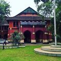 നോർത്ത് പറവൂർ കോടതി സമുച്ചയം


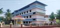 ശ്രീ നാരായണ ഹയർ സെക്കന്ററി സ്കൂൾ നോർത്ത് പറവൂർ
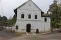 Jewish Synagogue


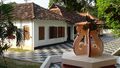 കേസരി ബാലക്രിഷ്ണ പിളള സ്മാരക മ്യുസിയം
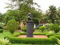 അംബേദ്കർ പാർക്ക്
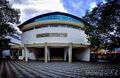 മുനിസിപ്പൽ ടൗൺ ഹാൾ
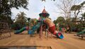 കുട്ടികളുടെ പാർക്ക്


